Auger Falls
By Armen Suny · Last verified May 2026

Photo Credits (1)
Difficulty
Moderate
Trail Length
4.6 miles
Trail Type
Loop
Elevation Gain
200 ft
About Auger Falls
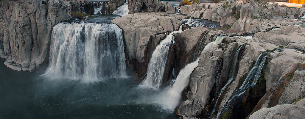
Auger Falls is a scenic waterfall located near Twin Falls, Idaho, along the Snake River. It is part of the Auger Falls Heritage Park, a popular area for hiking, biking, and enjoying the natural beauty of the region. The waterfall is surrounded by basalt cliffs and offers picturesque views.
The Setting
Auger Falls sits at 3,025 feet along the Snake River, in the mountains of Idaho.
Nearby Falls Worth Visiting
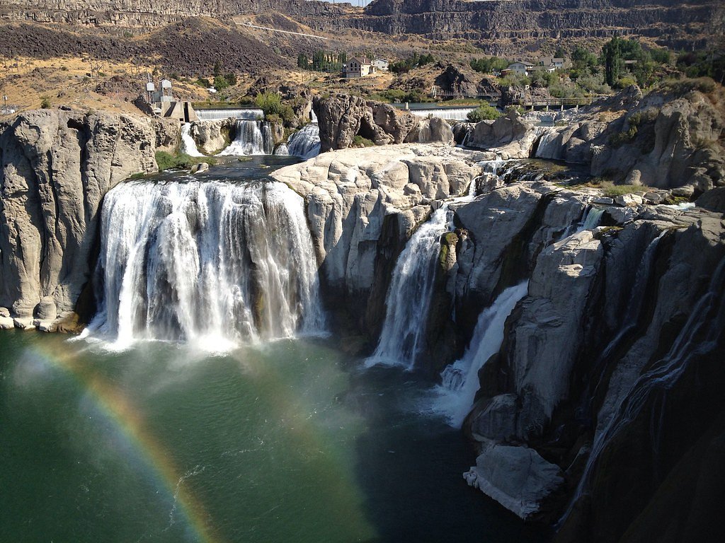
Shoshone Falls, the tallest waterfall in Idaho at 212 feet, lies 6.9 miles to the east. Also nearby: Perrine Coulee Falls (200 ft, 3.7 mi).
Trail & Hike Details
The Approach
The moderate 4.6-mile loop trail gains 200 feet of elevation on the way to the falls.
Trail Description
The trail to Auger Falls is a well-maintained loop trail that winds through the scenic Snake River Canyon. It features a mix of dirt paths and rocky terrain, with some gentle elevation changes. The trail offers views of the river, basalt cliffs, and the surrounding desert landscape. The waterfall itself is a highlight of the hike, with water cascading over rugged rocks into the Snake River.
What to Expect
Dogs are welcome.
Accessibility
The trail is not wheelchair accessible. Uneven terrain and elevation changes require steady footing.
Frequently Asked Questions
🐶 Are Dogs Allowed at Auger Falls?
✅ Dogs are allowed
Are There Any Fees or Permits Required?
🆖 No fees required
🏊 Is There Swimming at Auger Falls?
❌ Swimming is not allowed
When to Visit
Spring and fall are the best times to visit, as temperatures are mild and the trail is less crowded. Summer can be hot, but mornings and evenings are still enjoyable.
Seasonal Access
The best time to visit is Spring, Summer, and Fall. Winter access may be limited.
Safety Information
Be cautious near the edge of the canyon and around the waterfall, as rocks can be slippery. Watch for mountain bikers on the trail. Carry sufficient water and be prepared for changing weather conditions.
Current Water Conditions
523 ft³/s
Current discharge — how much water is flowing
Much lower than usual for this time of year
Based on 51 years of record
1.86 ft
Water depth at gauge
7-Day Discharge Trend
What does this mean for your visit?
Flow is well below normal for this time of year, so the waterfall may be a trickle.
About This Gauge
7-Day Flow Outlook
Based on the USGS gauge SNAKE RIVER NR TWIN FALLS ID (5 km away).
Today
Moderate
534 cfs
8/10Tomorrow
Moderate
534 cfs
6/10Sun
Moderate
534 cfs
6/10Mon
Moderate
534 cfs
8/10Tue
Moderate
534 cfs
6/10Wed
Moderate
534 cfs
8/10Thu
Moderate
545 cfs
8/10Best window: Today — moderate flow, mostly sunny (trip score 8/10).
Best time of year: this gauge typically runs highest from late March to late April, peaking in April.
How we calculate this
This is a transparent outlook, not a precise forecast. We take the waterfall's current flow strength (how it ranks against its historical normal for today, from the nearest USGS stream gauge), carry that ranking forward along the gauge's seasonal curve, and nudge it for forecast rain. Confidence is highest for the next day or two and falls further out. Always check official conditions and your own judgment before visiting — high flows can be dangerous.
Know when to go.
Get a free email alert when waterfalls near Jerome hit peak flow. We only send when conditions are worth the trip — no weekly newsletters, no spam.
Weather Forecast
Location & Access
Getting There
Auger Falls can be accessed via Auger Falls Heritage Park, located west of Twin Falls, Idaho. From Twin Falls, take Canyon Springs Road down into the Snake River Canyon and follow signs to the park. The trailhead to the falls is located within the park.
Get Directions on Google MapsParking
There is a parking area available at the Auger Falls Heritage Park trailhead.
Elevation
3,025 feet above sea level
Coordinates
42.632131° N, -114.527264° W
Visitor Tips & Gear
Wear sturdy hiking shoes, as the trail can be rocky in some sections. Bring plenty of water, especially during warmer months, as the area can get hot. Start early in the day to avoid crowds and enjoy cooler temperatures.
As an Amazon Associate, we earn from qualifying purchases.
With 4.6 miles and 200 ft of elevation gain, sturdy boots and trekking poles will help on this moderate trail. Sun exposure on the trail makes good sun protection a must in summer.

Polarized Sunglasses (Knockaround)
Cuts glare off the water so you actually see the falls — and your photos turn out better too.

Columbia Watertight II Rain Jacket
Packs into its own pocket, seam-sealed, and keeps you dry from spray and surprise rain.

Earth Pak Waterproof Dry Bag
Keeps your phone and gear dry when waterfall mist soaks everything else.

Waterproof Phone Pouch (AiRunTech)
Cheap insurance — take photos right next to the falls without killing your phone.

Timberland Euro Sprint Mid Waterproof
Trusted waterproof boot with premium leather and grippy rubber sole — reliable on rocky, wet trails.

TrailBuddy Trekking Poles
Lightweight aluminum, cork grips, and flip-locks that actually hold — a best-seller for good reason.
Where to Stay

La Quinta by Wyndham Twin Falls

SureStay Hotel by Best Western Twin Falls

Holiday Inn Twin Falls by IHG

Comfort Inn & Suites Jerome - Twin Falls
Browse vacation cabins and private rentals nearby
Unique outdoor stays — tents, yurts, and treehouses
Rent a campervan or RV for your waterfall road trip
Some links are affiliate links. We may earn a commission at no extra cost to you.
Nearby Hot Springs
Hot springs near Jerome, Idaho
Nat Soo Pah Warm Spring
Nat-Soo-Pah Warm Spring flows at a body-friendly 97°F in Twin Falls County, Idaho, on BLM land just 550 feet from Hoppers Gulch...
Banbury Hot Spring
Banbury Hot Spring fires out at 138 degrees Fahrenheit near Buhl in Twin Falls County, one of the hottest thermal features in t...
Poison Springs
Poison Springs sits on BLM land near Buhl in Twin Falls County, Idaho, at 3,388 feet elevation. The original temperature was re...
Hot Sulphur (Miracle Hot) Springs
Known locally as Miracle Hot Springs, this Twin Falls County source flows at 131 degrees Fahrenheit near Buhl in the Snake Rive...
Salmon Falls Hot Spring
Salmon Falls Hot Spring pushes 153-degree water to the surface just six feet from North 1000 East road in Twin Falls County, on...
Artesian City Hot Springs
Artesian City Hot Springs flows at 99 degrees Fahrenheit in the agricultural flatlands of Twin Falls County, one of several geo...
Looking for a soak after your hike? Explore more hot springs near Jerome, Idaho on SoakingSprings.
Explore Idaho springsAdditional Information
Nearby Attractions
Nearby attractions include Shoshone Falls, Perrine Bridge, and the Snake River Canyon Rim Trail.
Wildlife
The area is home to various bird species, including hawks and eagles, as well as small mammals like rabbits and squirrels.
Cities near Auger Falls
Nearby Waterfalls
Other waterfalls named Auger Falls
1 other waterfall shares this name across the U.S.
Writing about Auger Falls? Embed this waterfall on your site for free.