Lower Falls
New York • 70 ft
By Armen Suny · Last verified Mar 2026
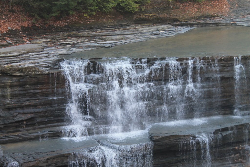
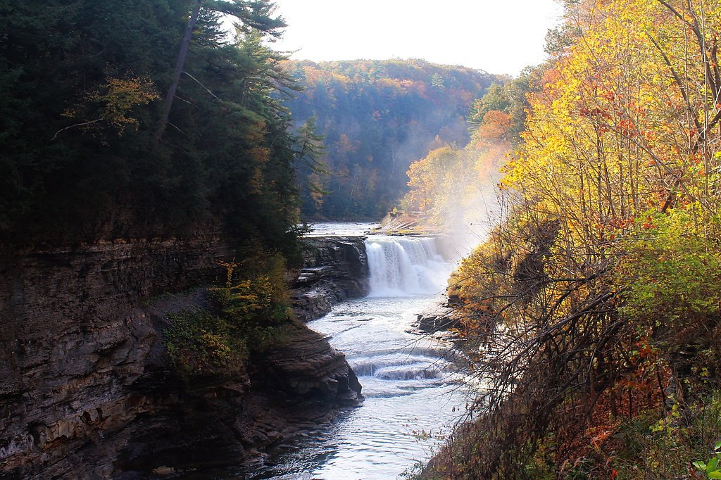
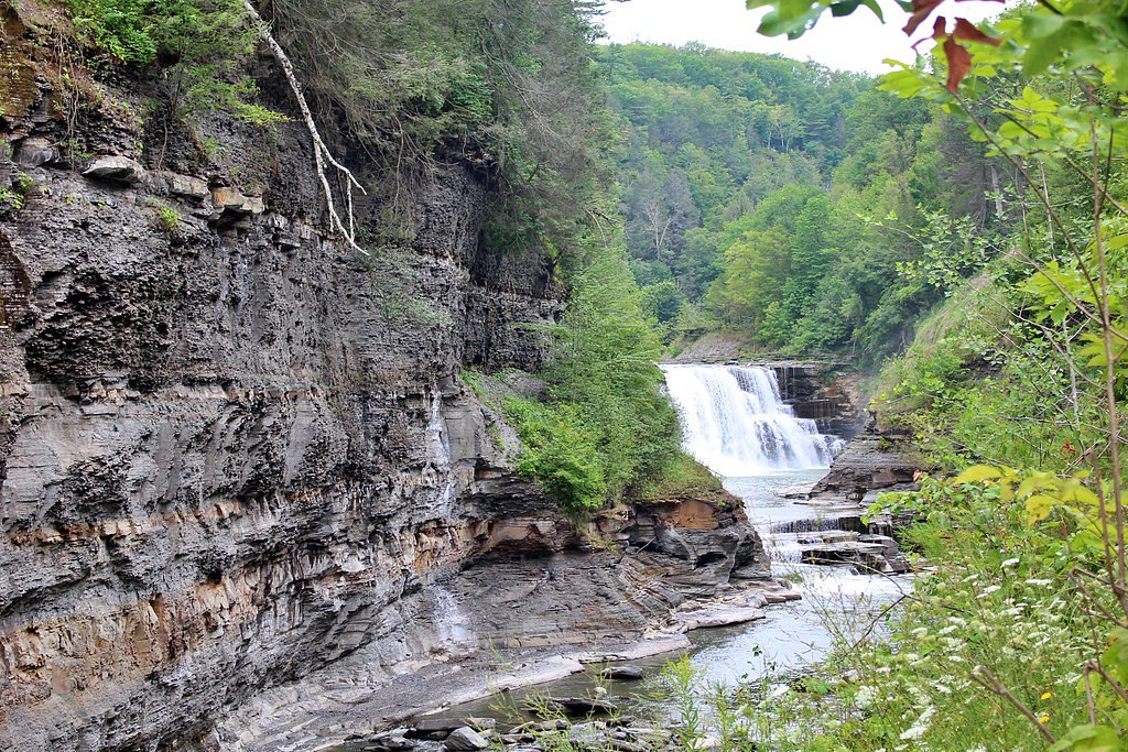
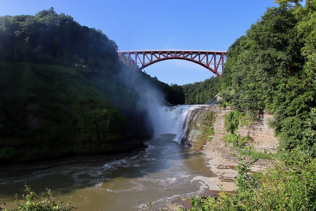

Photo Credits (5)
Difficulty
Moderate
Trail Length
1.5 miles
Trail Type
Out And Back
Elevation Gain
200 ft
About Lower Falls
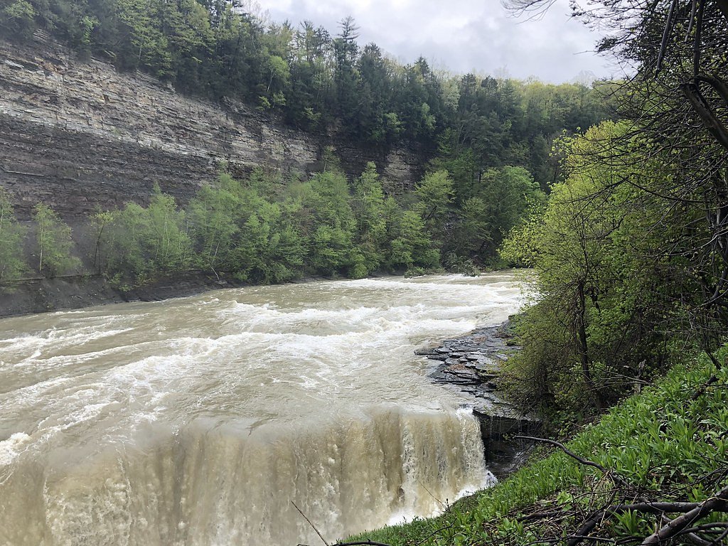
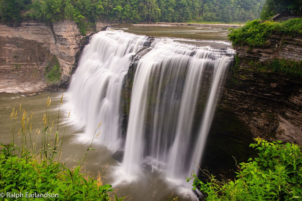
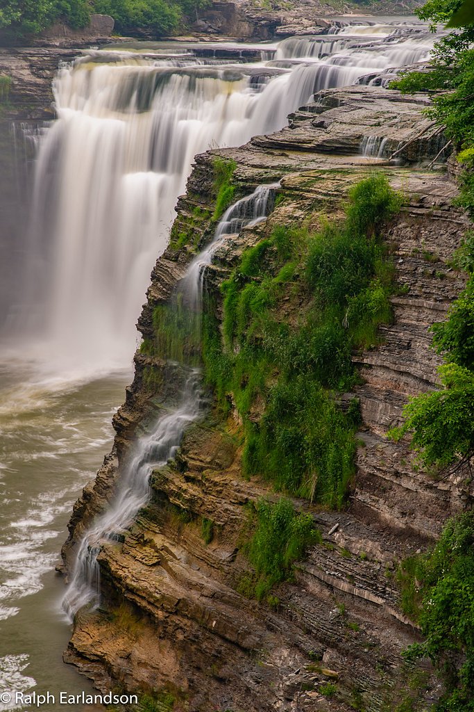
Lower Falls, also known as Inspiration Falls, is one of the three major waterfalls located in Letchworth State Park, often referred to as the 'Grand Canyon of the East.' It is a stunning cascade along the Genesee River, surrounded by dramatic cliffs and lush forest.
The Setting
Lower Falls sits at 820 feet within Letchworth State Park, fed by the Genesee River, in the foothills of New York. The falls drop 70 feet.
Height: 70 feet
Nearby Falls Worth Visiting
Middle Falls (107 ft) lies 1.1 miles to the west. Also nearby: Upper Falls (70 ft, 1.5 mi).
Trail & Hike Details
The Approach
The moderate 1.5-mile out-and-back trail gains 200 feet of elevation on the way to the falls.
Trail Description
The trail to Lower Falls is a moderately challenging hike with some steep sections and stairs. It offers beautiful views of the Genesee River and the surrounding gorge. The trail is well-maintained but can be slippery after rain or during the winter months.
What to Expect
The falls drop 70 feet. Dogs are welcome.
Accessibility
The trail is not wheelchair accessible. Uneven terrain and elevation changes require steady footing.
Frequently Asked Questions
🐶 Are Dogs Allowed at Lower Falls?
✅ Dogs are allowed
Are There Any Fees or Permits Required?
🤑 Fee: $10.00
🏊 Is There Swimming at Lower Falls?
❌ Swimming is not allowed
When to Visit
Spring and early summer are ideal for visiting Lower Falls, as the water flow is typically at its peak. Fall offers stunning foliage, while winter provides a unique view of the frozen waterfall.
Seasonal Access
The best time to visit is Spring, Summer, and Fall. Winter access may be limited.
Safety Information
Exercise caution near the edges of the gorge and on slippery sections of the trail. Stay on marked trails and avoid venturing too close to the water.
Current Water Conditions
2,380 ft³/s
Current discharge — how much water is flowing
Much higher than usual for this time of year
Based on 118 years of record
10.78 ft
Water depth at gauge
7-Day Discharge Trend
What does this mean for your visit?
The water is flowing much higher than usual, expect an impressive display.
About This Gauge
7-Day Flow Outlook
Based on the USGS gauge GENESEE RIVER AT PORTAGEVILLE NY (2 km away).
Today
Strong
2570 cfs
8/10Tomorrow
Strong
2676 cfs
9/10Sun
Strong
2514 cfs
9/10Mon
Strong
2559 cfs
10/10Tue
Strong
2797 cfs
10/10Wed
Strong
2667 cfs
8/10Thu
Roaring
3199 cfs
6/10Best window: Mon — strong flow, sunny (trip score 10/10).
Best time of year: this gauge typically runs highest from late February to early May, peaking in April.
How we calculate this
This is a transparent outlook, not a precise forecast. We take the waterfall's current flow strength (how it ranks against its historical normal for today, from the nearest USGS stream gauge), carry that ranking forward along the gauge's seasonal curve, and nudge it for forecast rain. Confidence is highest for the next day or two and falls further out. Always check official conditions and your own judgment before visiting — high flows can be dangerous.
Know when to go.
Get a free email alert when waterfalls near Hunt hit peak flow. We only send when conditions are worth the trip — no weekly newsletters, no spam.
Weather Forecast
Location & Access
Getting There
Lower Falls is located within Letchworth State Park in New York. The closest entrances to the park are near the towns of Hunt, Dalton, and Silver Springs. The waterfall is accessible via the Lower Falls Trail, which begins near the Lower Falls parking area.
Get Directions on Google MapsParking
Parking is available at the Lower Falls parking area within Letchworth State Park. The parking lot is well-marked and located near the trailhead.
Elevation
820 feet above sea level
Coordinates
42.585341° N, -78.020561° W
Land Management
Managed by SPR
Visitor Tips & Gear
Wear sturdy footwear, as the trail can be uneven and slippery. Arrive early during peak seasons to secure parking and avoid crowds. Bring water and snacks, as there are limited facilities near the trail.
As an Amazon Associate, we earn from qualifying purchases.
With 1.5 miles and 200 ft of elevation gain, sturdy boots and trekking poles will help on this moderate trail. Sun exposure on the trail makes good sun protection a must in summer.

Polarized Sunglasses (Knockaround)
Cuts glare off the water so you actually see the falls — and your photos turn out better too.

Columbia Watertight II Rain Jacket
Packs into its own pocket, seam-sealed, and keeps you dry from spray and surprise rain.

Earth Pak Waterproof Dry Bag
Keeps your phone and gear dry when waterfall mist soaks everything else.

Waterproof Phone Pouch (AiRunTech)
Cheap insurance — take photos right next to the falls without killing your phone.

Timberland Euro Sprint Mid Waterproof
Trusted waterproof boot with premium leather and grippy rubber sole — reliable on rocky, wet trails.

TrailBuddy Trekking Poles
Lightweight aluminum, cork grips, and flip-locks that actually hold — a best-seller for good reason.
Where to Stay
Letchworth Farm Guesthouses

Hampton Inn Geneseo
Microtel Inn & Suites by Wyndham Warsaw
Conesus Lake Glamping With A View
Browse vacation cabins and private rentals nearby
Unique outdoor stays — tents, yurts, and treehouses
Rent a campervan or RV for your waterfall road trip
Some links are affiliate links. We may earn a commission at no extra cost to you.
Nearby Campground
Kanakadea Recreation Area
22.6 miles away · 0 sites
This recreation area is part of Almond Lake
Book on Recreation.govAdditional Information
Nearby Attractions
Other waterfalls in Letchworth State Park, including Middle Falls and Upper Falls. The park also offers hiking trails, picnic areas, and scenic overlooks.
Wildlife
The area is home to deer, birds, and other wildlife. Keep an eye out for bald eagles, which are occasionally spotted in the park.
Cities near Lower Falls
Nearby Waterfalls
Other waterfalls named Lower Falls
19 other waterfalls share this name across the U.S.
Writing about Lower Falls? Embed this waterfall on your site for free.